Elevation Aerial Imaging
Drone Services
Serving the
Triad and Triangle Areas of North Carolina

ABOUT OUR COMPANY
Our company is based in the Triad Area of North Carolina and is locally owned and operated. We serve the Triad and Triangle area of North Carolina, as well as southern Virginia, with drone services.
To view our drone content, visit our YouTube Channel by clicking here.
We are Part 107 FAA Certified, which is required to operate a commercial drone business in the United States. We have also obtained the North Carolina Commercial UAS Operator Permit and have liability insurance of $1,000,000
OUR SERVICES


Multispectral Mapping
Our company specializes in providing cutting-edge multispectral mapping services, leveraging the latest technology to deliver unparalleled insights. Through advanced aerial imaging and sensor technology, we capture a wealth of data across multiple spectral bands, allowing for detailed analysis and interpretation. Our team of experts then utilizes this information to empower clients across various sectors, from agriculture to environmental monitoring, enabling them to make informed decisions that drive efficiency, sustainability, and growth. Whether it’s precision agriculture, land management, or ecosystem monitoring, our multispectral mapping services unlock a new dimension of understanding for our clients, leading to enhanced resource management and informed strategic planning.


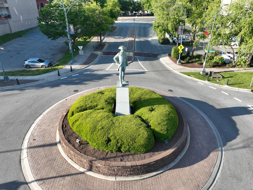
AERIAL PHOTOGRAPHY
Our company specializes in providing high-quality aerial photography services tailored for real estate and construction monitoring purposes. By leveraging advanced drone technology and state-of-the-art equipment, we capture stunning aerial images and videos that showcase properties, construction progress, and land development from unique angles. Our expertise extends to aerial surveys, progress tracking, and delivering actionable insights through our comprehensive visual data. Whether you’re a real estate professional seeking to showcase properties in a captivating way or a construction project manager needing accurate monitoring, our aerial photography services are designed to meet your specific needs with precision and excellence.
CONTACT US
For inquiries about our drone services or to discuss a potential project, feel free to reach out to us:
Phone: (336)-447-3782
Email: kelly@elevationaerialimaging.com
We are committed to providing professional and reliable drone services tailored to meet your specific needs. Get in touch with us today to learn more about how we can assist you with our Multispectral mapping services, as well as aerial photography.